
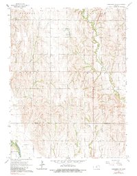
1965 Map of Concordia NW
USGS Topo · Published 1966About this map
Agricultural lands and prairie drainages define this mid-1960s landscape along the border of Republic and Cloud counties. The terrain is deeply incised by a network of waterways including West Creek, Hay Creek, and Coal Creek, which feed toward the broad valley of the Republican River in the southwestern corner. This survey documents the rural character of several townships, including Norway, Lincoln, and Sibley, showing a pattern of section-line roads and scattered farmsteads typical of the Great Plains.
Find a feature on this map
20 named features on this map. Tap any name to fly to it.
Don’t see what you’re looking for? This feature index may not catch every label — zoom into the map to look around manually.
Map Details
Editions of this 1965 Concordia NW Map
2 editions found
Other maps of this area

1892 · Concordia
USGS Topo · 1:125,000

1955 · Manhattan
USGS Topo · 1:250,000

1956 · Manhattan
USGS Topo · 1:250,000

1957 · Manhattan
USGS Topo · 1:250,000

1965 · Wayne
USGS Topo · 1:24,000
1965 · Rice
USGS Topo · 1:24,000
1965 · Concordia
USGS Topo · 1:24,000

1965 · Kackley
USGS Topo · 1:24,000

1966 · Scandia
USGS Topo · 1:24,000
1966 · Belleville SE
USGS Topo · 1:24,000