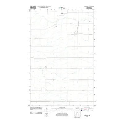
2011 Map of Concrete
USGS Topo · Published 2011About this map
Saint Ellens Cemetery and West Mountain Cemetery anchor this rural landscape in Pembina County, providing essential points of reference for genealogists and local historians. The small settlement of Concrete sits along the northern edge of the map, adjacent to the meandering course of the Tongue River. The terrain is defined by a series of parallel waterways, including Willow Creek and Cart Creek, which flow eastward through a grid of section roads and agricultural tracts. This 2011 survey by the U.S. Geological Survey captures the modern configuration of the local road network, from major arteries like County Hwy 6 to residential lanes such as Roen Rd and Spraker Dr. The inclusion of Olson Dam on the Tongue River illustrates the continued importance of water management in this northeastern North Dakota prairie environment.
Find a feature on this map
23 named features on this map. Tap any name to fly to it.
Don’t see what you’re looking for? This feature index may not catch every label — zoom into the map to look around manually.
Map Details
Editions of this 2011 Concrete Map
This is the sole edition of this map. No revisions or reprints were ever made.
Other maps of this area

1918 · Walhalla
USGS Topo · 1:62,500

1943 · Walhalla
USGS Topo · 1:62,500

1952 · Thief River Falls
USGS Topo · 1:250,000

1953 · Devils Lake
USGS Topo · 1:250,000

1956 · Thief River Falls
USGS Topo · 1:250,000

1956 · Devils Lake
USGS Topo · 1:250,000

1957 · Thief River Falls
USGS Topo · 1:250,000

1963 · Gardar
USGS Topo · 1:24,000

1964 · Mountain
USGS Topo · 1:24,000

1964 · Hallson
USGS Topo · 1:24,000