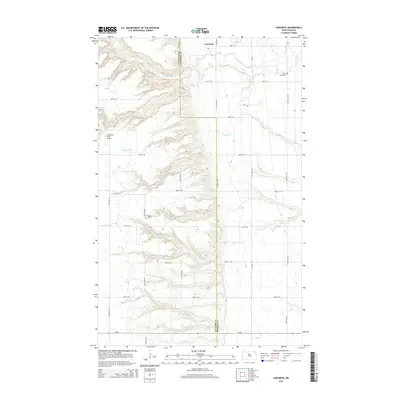
2014 Map of Concrete
USGS Topo · Published 2014About this map
The boundary between Cavalier County and Pembina County runs through this section of North Dakota, where the Tongue River and its tributaries carve through the plains. The small settlement of Concrete sits in the northeast corner of the sheet, serving as a focal point for the surrounding agricultural community. Traces of local heritage are visible at Saint Ellens Cemetery and W Mtn Cemetery, reflecting the rural burial grounds typical of the region. The landscape is defined by the drainages of Willow Cr and Cart Cr, which dictate the local topography and road placement. General aviation is represented by the Goodman Strip Airport, while ND-66 provides the primary east-west transportation link across the southern portion of the area. This map reveals a late-era perspective of a landscape where modern infrastructure and historic landmarks coexist along the county line.
Find a feature on this map
18 named features on this map. Tap any name to fly to it.
Don’t see what you’re looking for? This feature index may not catch every label — zoom into the map to look around manually.
Map Details
Editions of this 2014 Concrete Map
This is the sole edition of this map. No revisions or reprints were ever made.
Other maps of this area

1918 · Walhalla
USGS Topo · 1:62,500

1943 · Walhalla
USGS Topo · 1:62,500

1952 · Thief River Falls
USGS Topo · 1:250,000

1953 · Devils Lake
USGS Topo · 1:250,000

1956 · Thief River Falls
USGS Topo · 1:250,000

1956 · Devils Lake
USGS Topo · 1:250,000

1957 · Thief River Falls
USGS Topo · 1:250,000

1963 · Gardar
USGS Topo · 1:24,000

1964 · Mountain
USGS Topo · 1:24,000

1964 · Hallson
USGS Topo · 1:24,000