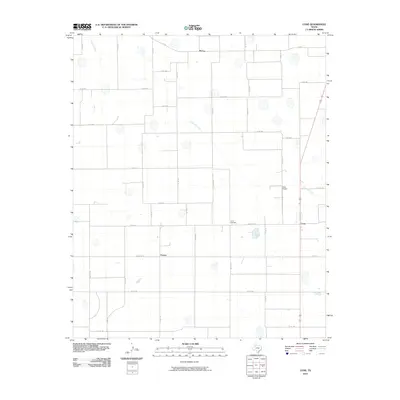
2010 Map of Cone
USGS Topo · Published 2010About this map
McCoy and the surrounding high plains of Floyd County are defined by a strict grid of county roads and intermittent playa lakes in this 2010 survey. The landscape reflects the systematic agricultural development of West Texas, where rural settlements like Farmer and Cone sit at key road intersections. Local life and history are anchored by landmarks such as the Cone Cemetery and the Cone Airport, while Crawfish Creek provides one of the few natural breaks in the otherwise geometric layout of the land. The mapping reveals a community built around large-scale farming, interconnected by a network of farm-to-market and ranch roads including Fm 54 and Ranch RD 193, which facilitate movement between these remote agricultural outposts.
Find a feature on this map
43 named features on this map. Tap any name to fly to it.
Don’t see what you’re looking for? This feature index may not catch every label — zoom into the map to look around manually.
Map Details
Editions of this 2010 Cone Map
This is the sole edition of this map. No revisions or reprints were ever made.
Other maps of this area

1954 · Lubbock
USGS Topo · 1:250,000

1965 · Petersburg
USGS Topo · 1:24,000

1965 · Lorenzo
USGS Topo · 1:24,000

1965 · Cone
USGS Topo · 1:24,000

1965 · Floydada
USGS Topo · 1:24,000

1965 · Floydada SE
USGS Topo · 1:24,000

1965 · Sandhill
USGS Topo · 1:24,000

1967 · Ralls NE
USGS Topo · 1:24,000

1967 · Ralls
USGS Topo · 1:24,000

1968 · Barwise
USGS Topo · 1:24,000