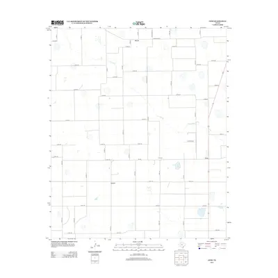
2012 Map of Cone
USGS Topo · Published 2012About this map
Cone stands as a focal point in this portion of Floyd County, marking a landscape defined by its grid of county roads and intermittent watercourses. The local geography is anchored by rural settlements and essential community sites, including the Cone Cem and the Cone Airport. The drainage of Crawfish Cr meanders through the central and northern sections, cutting across a strictly organized network of routes such as Ranch Road 54 and Ranch Road 3111. Smaller community identifiers like McCoy in the north and Farmer to the south illustrate the persistent agricultural settlement pattern of the Texas High Plains. This 2012 survey by the U.S. Geological Survey captures the region's transition between wide-open spaces and the clustered landmarks that define local history and family heritage.
Find a feature on this map
47 named features on this map. Tap any name to fly to it.
Don’t see what you’re looking for? This feature index may not catch every label — zoom into the map to look around manually.
Map Details
Editions of this 2012 Cone Map
This is the sole edition of this map. No revisions or reprints were ever made.
Other maps of this area

1954 · Lubbock
USGS Topo · 1:250,000

1965 · Petersburg
USGS Topo · 1:24,000

1965 · Lorenzo
USGS Topo · 1:24,000

1965 · Cone
USGS Topo · 1:24,000

1965 · Floydada
USGS Topo · 1:24,000

1965 · Floydada SE
USGS Topo · 1:24,000

1965 · Sandhill
USGS Topo · 1:24,000

1967 · Ralls NE
USGS Topo · 1:24,000

1967 · Ralls
USGS Topo · 1:24,000

1968 · Barwise
USGS Topo · 1:24,000