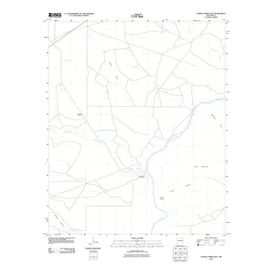
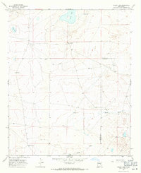
2010 Map of Conejo Creek East
USGS Topo · Published 2010About this map
The Pecos River carves a central path through this De Baca County landscape, defining the local geography as it flows past the Trigg Ranch River Camp. This arid region is characterized by a complex drainage system including Conejo Creek, Yeso Creek, and the long stretches of Alamo Draw and Eightmile Draw. The terrain is marked by significant vertical relief, notably at Baldy Mountain and within the deep cuts of Crane Canyon and Blanco Canyon. Water security in this ranching environment is evidenced by groundwater features like Shaw Spring, Blanco Spring Number 2, and the specifically named Rattlesnake Windmill, which serve as vital landmarks for understanding the area's agricultural and ranching history.
Find a feature on this map
12 named features on this map. Tap any name to fly to it.
Don’t see what you’re looking for? This feature index may not catch every label — zoom into the map to look around manually.
Map Details
Editions of this 2010 Conejo Creek East Map
This is the sole edition of this map. No revisions or reprints were ever made.
Other maps of this area

1954 · Fort Sumner
USGS Topo · 1:250,000

1958 · Fort Sumner
USGS Topo · 1:250,000

1966 · West Camp
USGS Topo · 1:24,000

1966 · Alamo Ranch
USGS Topo · 1:24,000

1967 · Eighteenmile Hill
USGS Topo · 1:24,000

1967 · Conejo Creek West
USGS Topo · 1:24,000
1967 · Lovelady Draw
USGS Topo · 1:24,000
1967 · La Espia Peak
USGS Topo · 1:24,000
1967 · Conejo Creek East
USGS Topo · 1:24,000
1967 · Cooley Lake
USGS Topo · 1:24,000