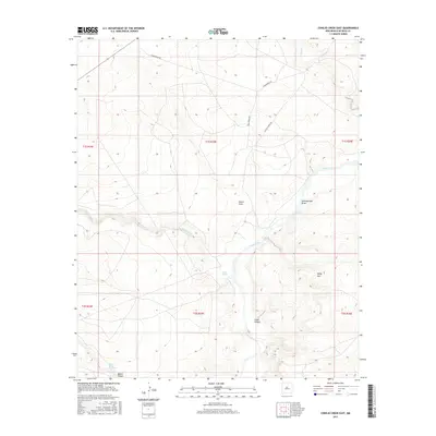
2017 Map of Conejo Creek East
USGS Topo · Published 2017About this map
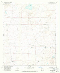
The Pecos River carves a winding path through this portion of De Baca County, defining a landscape of deep draws and seasonal watercourses. Significant hydrologic features like Shaw Spring and Blanco Spring Number 2 provide critical water points in an otherwise arid region characterized by the broad depressions of Alamo Draw and Eighteenmile Draw. The terrain is marked by notable elevations such as Baldy Mtn and the steep descents into Blanco Canyon and Crane Canyon. Rural access is maintained via unpaved routes including Tumbleweed Rd and Shaw Spring Rd, which navigate the township and range grid. This 2017 survey reflects the enduring cattle-ranching geography of eastern New Mexico, where land use is dictated by the availability of water from the river and its small tributaries like Conejo Creek and Yeso Cr.
Find a feature on this map
19 named features on this map. Tap any name to fly to it.
Don’t see what you’re looking for? This feature index may not catch every label — zoom into the map to look around manually.
Map Details
Editions of this 2017 Conejo Creek East Map
This is the sole edition of this map. No revisions or reprints were ever made.
Other maps of this area

1954 · Fort Sumner
USGS Topo · 1:250,000

1958 · Fort Sumner
USGS Topo · 1:250,000

1966 · West Camp
USGS Topo · 1:24,000

1966 · Alamo Ranch
USGS Topo · 1:24,000

1967 · Eighteenmile Hill
USGS Topo · 1:24,000

1967 · Conejo Creek West
USGS Topo · 1:24,000
1967 · Lovelady Draw
USGS Topo · 1:24,000
1967 · La Espia Peak
USGS Topo · 1:24,000
1967 · Conejo Creek East
USGS Topo · 1:24,000
1967 · Cooley Lake
USGS Topo · 1:24,000