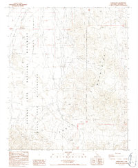
1986 Map of Conejo Well
USGS Topo · Published 1987About this map
Eagle Mountains dominate the southern landscape of this mid-1980s Riverside County survey, where the high desert terrain meets the low-lying Pinto Basin. The area is defined by its status as part of the Joshua Tree National Monument, including the designated Joshua Tree Wilderness. A notable point of human activity is the Storm Jade Mine in the northeast, reflecting the region's history of mineral exploration. Water sources are characteristically scarce in this arid environment, evidenced by the presence of Conejo Well (Dry). The map provides a detailed view of the township and range lines, such as T 3 S T 4 S, illustrating the precision of late 20th-century topographic mapping before the monument was redesigned as a national park.
Find a feature on this map
9 named features on this map. Tap any name to fly to it.
Don’t see what you’re looking for? This feature index may not catch every label — zoom into the map to look around manually.
Map Details
Editions of this 1986 Conejo Well Map
2 editions found
Other maps of this area

1940 · Cottonwood Spring
USGS Topo · 1:62,500

1940 · Canyon Spring
USGS Topo · 1:62,500

1943 · Canyon Spring
USGS Topo · 1:62,500

1943 · Pinkham Well
USGS Topo · 1:62,500

1944 · Cottonwood Spring
USGS Topo · 1:62,500

1944 · Pinkham Well
USGS Topo · 1:62,500

1944 · Eagle Tank
USGS Topo · 1:62,500

1954 · Salton Sea
USGS Topo · 1:250,000

1955 · Salton Sea
USGS Topo · 1:250,000
1958 · Cottonwood Spring
USGS Topo · 1:62,500