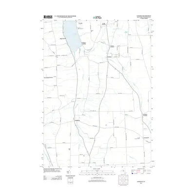
2013 Map of Conesus
USGS Topo · Published 2013About this map
Conesus Lake anchors the northern portion of this landscape, its eastern shore dotted with points like Walkleys Landing and Maple Beach RD. The terrain transitions into a patchwork of agricultural fields and small hamlets, with Conesus serving as a central hub where North McMillan Cr flows toward the Livonia Reservoir. To the south, the Conesus Inlet winds through low-lying ground toward the settlement of Scottsburg, while higher elevations like Turkey Hill and Logan Hill define the surrounding topography. Genealogical interest is high throughout the township, with several historic burial grounds such as Lakeview Cem, Union Cem, and Rau Cem preserved across the countryside. The southern extent includes smaller communities like Websters Crossing and Libertypole, linked by a network of rural roads that reflect generations of homesteading and dairy farming history in Livingston County.
Find a feature on this map
66 named features on this map. Tap any name to fly to it.
Don’t see what you’re looking for? This feature index may not catch every label — zoom into the map to look around manually.
Map Details
Editions of this 2013 Conesus Map
This is the sole edition of this map. No revisions or reprints were ever made.
Other maps of this area

1901 · Honeoye
USGS Topo · 1:62,500

1902 · Wayland
USGS Topo · 1:62,500

1904 · Wayland
USGS Topo · 1:62,500

1904 · Caledonia
USGS Topo · 1:62,500

1904 · Honeoye
USGS Topo · 1:62,500

1905 · Nunda
USGS Topo · 1:62,500

1942 · Springwater
USGS Topo · 1:31,680

1942 · Wayland
USGS Topo · 1:31,680
1942 · Honeoye
USGS Topo · 1:31,680

1942 · Dansville
USGS Topo · 1:31,680