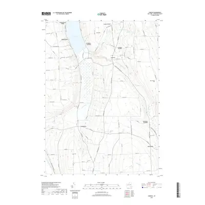
2019 Map of Conesus
USGS Topo · Published 2019About this map
Conesus Lake defines the northern edge of this Livingston County landscape, where the water gives way to the broad, marshy reach of the Conesus Inlet. The area is characterized by a high concentration of small, family-named cemeteries and rural crossroads that hint at generations of local history. Settlements such as Scottsburg and Websters Crossing are linked by a network of historic routes like Conesus Springwater Rd and S Livonia Rd. Genealogists will find several distinct burial sites across the township, including Union Cem, Arnold Cem, and Rau Cem. To the east, the terrain rises toward Marrowback Hill, overlooking the Livonia Reservoir and the winding course of McMillan Cr. This study provides a clear view of the transition from the lakefront landings of Maple Beach and Walkleys Landing to the upland farms of Libertypole.
Find a feature on this map
97 named features on this map. Tap any name to fly to it.
Don’t see what you’re looking for? This feature index may not catch every label — zoom into the map to look around manually.
Map Details
Editions of this 2019 Conesus Map
This is the sole edition of this map. No revisions or reprints were ever made.
Other maps of this area

1901 · Honeoye
USGS Topo · 1:62,500

1902 · Wayland
USGS Topo · 1:62,500

1904 · Wayland
USGS Topo · 1:62,500

1904 · Caledonia
USGS Topo · 1:62,500

1904 · Honeoye
USGS Topo · 1:62,500

1905 · Nunda
USGS Topo · 1:62,500

1942 · Springwater
USGS Topo · 1:31,680

1942 · Wayland
USGS Topo · 1:31,680
1942 · Honeoye
USGS Topo · 1:31,680

1942 · Dansville
USGS Topo · 1:31,680