
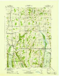
1942 Map of Conesus
USGS Topo · Published 1942About this map
Conesus Lake dominates the northern landscape of this Livingston County region, where 1940s shoreline communities like Cottonwood Pt and Maple Beach offer a glimpse into the area's development as a summer destination. The steep eastern and western slopes transition into a high plateau dominated by agriculture and small hamlets. Significant local landmarks include St Michaels Mission and a network of rural schools, such as School No 9 and School No 5, which served the scattered farming population.
Find a feature on this map
52 named features on this map. Tap any name to fly to it.
Don’t see what you’re looking for? This feature index may not catch every label — zoom into the map to look around manually.
Map Details
Editions of this 1942 Conesus Map
This is the sole edition of this map. No revisions or reprints were ever made.
Other maps of this area

1901 · Honeoye
USGS Topo · 1:62,500

1902 · Wayland
USGS Topo · 1:62,500

1904 · Wayland
USGS Topo · 1:62,500

1904 · Caledonia
USGS Topo · 1:62,500

1904 · Honeoye
USGS Topo · 1:62,500

1905 · Nunda
USGS Topo · 1:62,500

1942 · Springwater
USGS Topo · 1:31,680

1942 · Wayland
USGS Topo · 1:31,680
1942 · Honeoye
USGS Topo · 1:31,680

1942 · Dansville
USGS Topo · 1:31,680