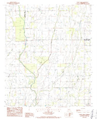
1986 Map of Congo Creek
USGS Topo · Published 1987About this map
Little Colewa Creek and Big Colewa Creek define this rural landscape along the boundary shared by Richland Parish and West Carroll Parish. This mid-1980s provisional study documents a region deeply influenced by drainage and utility infrastructure, where multiple pipelines and a high-voltage trans line intersect the agricultural bottomlands. The presence of an Old RR Grade in the northeast corner of the map provides a tangible link to former transportation corridors that once served this part of Louisiana.
Find a feature on this map
13 named features on this map. Tap any name to fly to it.
Don’t see what you’re looking for? This feature index may not catch every label — zoom into the map to look around manually.
Map Details
Editions of this 1986 Congo Creek Map
This is the sole edition of this map. No revisions or reprints were ever made.
Other maps of this area

1935 · Baskinton
USGS Topo · 1:62,500

1935 · Hurricane
USGS Topo · 1:62,500

1935 · Waverly
USGS Topo · 1:62,500

1955 · Jackson
USGS Topo · 1:250,000

1958 · Baskinton
USGS Topo · 1:62,500

1958 · Hurricane
USGS Topo · 1:62,500

1959 · Mitchiner
USGS Topo · 1:62,500

1961 · Jackson
USGS Topo · 1:250,000

1961 · Waverly
USGS Topo · 1:62,500

1962 · Jackson
USGS Topo · 1:250,000