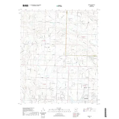
2020 Map of Congo
USGS Topo · Published 2020About this map
Hurricane Creek and its many tributaries, including Little Hurricane Cr and Dry Cr, carve through the landscape of central Arkansas between the growing hubs of Bryant and Benton. This 2020 survey reveals the complex drainage patterns of the region, where water bodies like Inman Lake Number Two and Hurricane Lake are surrounded by residential expansion and rural settlements. Historically significant points for genealogists include Pipkin Cem and Cameron Cem, which sit near the namesake community of Congo. The terrain transitions from the elevations of Big Ridge in the northwest toward the more developed corridors of Salem and Avilla in the south and east. Modern transportation and infrastructure, such as the Crystal Ridge Airport, are mapped alongside traditional natural boundaries like the North Fork Saline River.
Find a feature on this map
200 named features on this map. Tap any name to fly to it.
Don’t see what you’re looking for? This feature index may not catch every label — zoom into the map to look around manually.
Map Details
Editions of this 2020 Congo Map
This is the sole edition of this map. No revisions or reprints were ever made.
Other maps of this area

1890 · Benton
USGS Topo · 1:125,000

1891 · Little Rock
USGS Topo · 1:125,000

1893 · Little Rock
USGS Topo · 1:125,000

1894 · Benton
USGS Topo · 1:125,000

1935 · Alexander
USGS Topo · 1:48,000

1938 · Benton
USGS Topo · 1:48,000

1941 · Alexander
USGS Topo · 1:62,500

1943 · Pinnacle Mtn
USGS Topo · 1:31,680

1944 · Benton
USGS Topo · 1:62,500

1944 · Alexander
USGS Topo · 1:31,680