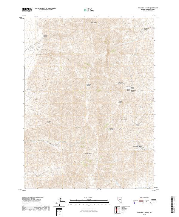
2021 Map of Congress Canyon
USGS Topo · Published 2021About this map
The Humboldt Range dominates this landscape in Pershing County, Nevada, defined by a complex network of steep drainage canyons and high-elevation basins. This survey illustrates the intricate topography of the region, where numerous forks and gulches like Peru Canyon and Peru Gulch converge. The naming of canyons such as Congress Canyon and Buena Vista Canyon suggests a history of prospectors and surveyors who moved through these corridors. Movement across the terrain is limited to primitive routes like Rocky Canyon Rd, which skirts the base of the ridges. Significant landmarks such as Fourth of July Flat provide rare level ground amidst the vertical relief of Wright Canyon and Rocky Canyon. Water resources are sparse, represented by intermittent flows in Coyote Cr and Indian Cr at the northern and southern edges of the range.
Find a feature on this map
32 named features on this map. Tap any name to fly to it.
Don’t see what you’re looking for? This feature index may not catch every label — zoom into the map to look around manually.
Map Details
Editions of this 2021 Congress Canyon Map
This is the sole edition of this map. No revisions or reprints were ever made.
Other maps of this area

1931 · Lovelock
USGS Topo · 1:250,000

1935 · Lovelock
USGS Topo · 1:250,000

1954 · Unionville
USGS Topo · 1:62,500

1955 · Lovelock
USGS Topo · 1:250,000

1956 · Oreana
USGS Topo · 1:62,500

1956 · Imlay
USGS Topo · 1:62,500

1959 · Lovelock
USGS Topo · 1:250,000

1971 · Rye Patch Reservoir South
USGS Topo · 1:24,000

1984 · Lovelock
USGS Topo · 1:100,000
1985 · Eugene Mts
USGS Topo · 1:100,000