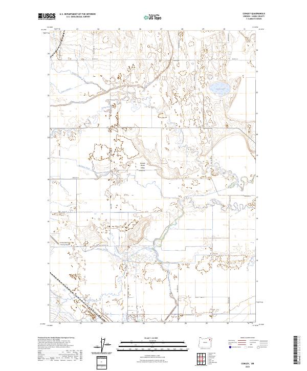
2023 Map of Conley
USGS Topo · Published 2023About this map
The Grande Ronde Valley floor reveals a complex system of water management and natural drainage near the La Grande/Union County Airport. This 2023 survey illustrates the agricultural character of the region through its reliance on intricate waterways like State Ditch and McAlister Ditch, which redirect flow across the flat terrain. The convergence of the Grande Ronde River and Catherine Creek dictates the landscape's movement, creating a network of sloughs such as Pierce Slough, Wright Slough, and Gekeler Slough. Historically significant landmarks like Conley Lake and the various rural lanes—Peach Rd, Anson Rd, and Gekeler Ln—provide a clear framework for those studying contemporary land use and property boundaries in this part of Union County.
Find a feature on this map
36 named features on this map. Tap any name to fly to it.
Don’t see what you’re looking for? This feature index may not catch every label — zoom into the map to look around manually.
Map Details
Editions of this 2023 Conley Map
This is the sole edition of this map. No revisions or reprints were ever made.
Other maps of this area

1906 · Telocaset
USGS Topo · 1:125,000

1953 · Pendleton
USGS Topo · 1:250,000

1955 · Grangeville
USGS Topo · 1:250,000

1956 · Pendleton
USGS Topo · 1:250,000

1959 · Grangeville
USGS Topo · 1:250,000

1963 · La Grande SE
USGS Topo · 1:24,000

1963 · Summerville
USGS Topo · 1:24,000

1965 · Conley
USGS Topo · 1:24,000
1965 · Glass Hill
USGS Topo · 1:24,000

1965 · Union
USGS Topo · 1:24,000