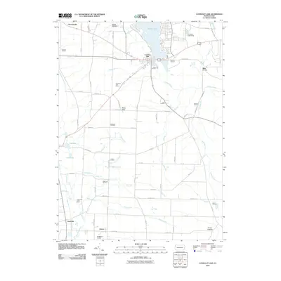
2010 Map of Conneaut Lake
USGS Topo · Published 2010About this map
Conneaut Lake serves as the central focal point of this Pennsylvania landscape, with its southern shores giving way to a network of creeks and marshes including Mud Lake and Lower Lake. The settlement pattern reveals a transition from the lakeside community to the agricultural and residential clusters of Shermansville, Adamsville, and West Vernon. A significant number of family-named burial grounds, such as Mushrush Cemetery, Adsit Cemetery, and Barber Cemetery, are scattered across the terrain, indicating long-established rural lineages.
Find a feature on this map
71 named features on this map. Tap any name to fly to it.
Don’t see what you’re looking for? This feature index may not catch every label — zoom into the map to look around manually.
Map Details
Editions of this 2010 Conneaut Lake Map
This is the sole edition of this map. No revisions or reprints were ever made.
Other maps of this area

1906 · Linesville
USGS Topo · 1:62,500

1908 · Shenango
USGS Topo · 1:62,500

1908 · Linesville
USGS Topo · 1:62,500

1911 · Stoneboro
USGS Topo · 1:62,500

1913 · Stoneboro
USGS Topo · 1:62,500

1923 · Meadville
USGS Topo · 1:62,500

1925 · Meadville
USGS Topo · 1:62,500

1943 · Meadville
USGS Topo · 1:62,500

1943 · Stoneboro
USGS Topo · 1:62,500

1950 · Cleveland
USGS Topo · 1:250,000
Featured Places
- Conneaut Lake, PA
- West Fallowfield Township, PA
- Stony Point, PA
- Greenwood Township, PA
- Vernon Township, PA