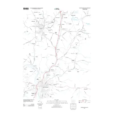
2013 Map of Connellsville
USGS Topo · Published 2013About this map
Scottdale and the northern reaches of Connellsville anchor this 2013 topographic study of the Fayette County corridor. The Youghiogheny River carves through the southwestern corner of the quadrangle, passing through Broad Ford and Adelaide, while the eastern landscape is defined by the steep slopes of Ore Mine Hill and Bark Hill. Historically significant hamlets and neighborhoods like West Overton, Everson, and Poplar Grove are visible alongside modern infrastructure like the Mount Pleasant/Scottdale Airport. The topography reveals a complex network of drainages, including Mounts Creek and Stauffer Run, which wind through a mosaic of residential blocks and industrial sites. From the Bullskin Fairgrounds in the east to the suburban clusters of North Manor and Greenwood Heights, the map documents the dense settlement patterns of the Laurel Highlands' western edge.
Find a feature on this map
201 named features on this map. Tap any name to fly to it.
Don’t see what you’re looking for? This feature index may not catch every label — zoom into the map to look around manually.
Map Details
Editions of this 2013 Connellsville Map
This is the sole edition of this map. No revisions or reprints were ever made.
Other maps of this area

1900 · Uniontown
USGS Topo · 1:62,500

1902 · Connellsville
USGS Topo · 1:62,500

1922 · Confluence
USGS Topo · 1:62,500

1922 · Donegal
USGS Topo · 1:62,500

1931 · Connellsville
USGS Topo · 1:62,500

1931 · Uniontown
USGS Topo · 1:62,500

1931 · Confluence
USGS Topo · 1:62,500

1933 · Confluence
USGS Topo · 1:62,500

1935 · Donegal
USGS Topo · 1:62,500

1936 · Connellsville
USGS Topo · 1:62,500