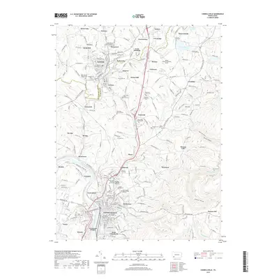
2019 Map of Connellsville
USGS Topo · Published 2019About this map
The Youghiogheny River winds through the heart of Fayette County, anchoring a landscape where industrial heritage and local geography converge. This 2019 survey captures the dense network of settlements and spiritual sites that define the region, from the commercial streets of Scottdale in the north to the neighborhoods of North Manor and Greenwood Heights further south. The map provides an intricate look at the area's religious and genealogical history, documented through numerous sites like Saint Joseph's Roman Catholic Cem Old and the Pennsville Baptist Cem.
Find a feature on this map
136 named features on this map. Tap any name to fly to it.
Don’t see what you’re looking for? This feature index may not catch every label — zoom into the map to look around manually.
Map Details
Editions of this 2019 Connellsville Map
This is the sole edition of this map. No revisions or reprints were ever made.
Other maps of this area

1900 · Uniontown
USGS Topo · 1:62,500

1902 · Connellsville
USGS Topo · 1:62,500

1922 · Confluence
USGS Topo · 1:62,500

1922 · Donegal
USGS Topo · 1:62,500

1931 · Connellsville
USGS Topo · 1:62,500

1931 · Uniontown
USGS Topo · 1:62,500

1931 · Confluence
USGS Topo · 1:62,500

1933 · Confluence
USGS Topo · 1:62,500

1935 · Donegal
USGS Topo · 1:62,500

1936 · Connellsville
USGS Topo · 1:62,500