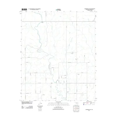
2012 Map of Connerville SE
USGS Topo · Published 2012About this map
The Blue River flows south through this portion of Johnston County, defining a landscape marked by numerous family and community burial grounds. Several distinct cataracts along the waterway, including Big Falls and Cheadle Falls, punctuate the river's path as it winds through the rural terrain. The area is interlaced with a grid of country roads and lanes such as S Bullard Chapel Rd and Deadman Spring Rd, reflecting a long-established rural settlement pattern that persists into the early 21st century.
Find a feature on this map
52 named features on this map. Tap any name to fly to it.
Don’t see what you’re looking for? This feature index may not catch every label — zoom into the map to look around manually.
Map Details
Editions of this 2012 Connerville SE Map
This is the sole edition of this map. No revisions or reprints were ever made.
Other maps of this area

1899 · Atoka
USGS Topo · 1:125,000

1900 · Atoka
USGS Topo · 1:125,000

1901 · Tishomingo
USGS Topo · 1:125,000

1957 · Ardmore
USGS Topo · 1:250,000

1963 · Ardmore
USGS Topo · 1:250,000

1967 · Connerville SE
USGS Topo · 1:24,000

1967 · Connerville
USGS Topo · 1:24,000
1967 · Connerville NE
USGS Topo · 1:24,000

1967 · Tishomingo
USGS Topo · 1:24,000
1967 · Reagan
USGS Topo · 1:24,000