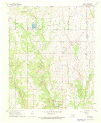
1967 Map of Reagan
USGS Topo · Published 1968About this map
Pennington Creek winds through this section of Johnston County, defining a landscape marked by small rural settlements and institutional land use in the late 1960s. The Tishomingo National Fish Hatchery occupies a prominent position north of Reagan, where a network of gravel roads connects local landmarks like Pennington Ch and Greenwood Cem. The map reveals a distinct focus on the outdoors and natural features, including a Boy Scout Camp situated near the descriptive terrain of Slippery Falls and the geological curiosity of Devils Den. Local family and place history is well-represented through scattered burials at Bullet Prairie Cem and Duncan Cem, while the abundance of mapped Gravel Pits suggests the importance of local material extraction to the area's mid-century infrastructure.
Find a feature on this map
27 named features on this map. Tap any name to fly to it.
Don’t see what you’re looking for? This feature index may not catch every label — zoom into the map to look around manually.
Map Details
Editions of this 1967 Reagan Map
2 editions found
Other maps of this area

1901 · Tishomingo
USGS Topo · 1:125,000

1957 · Ardmore
USGS Topo · 1:250,000

1963 · Ardmore
USGS Topo · 1:250,000

1963 · Mill Creek
USGS Topo · 1:24,000

1963 · Troy
USGS Topo · 1:24,000

1963 · Ravia
USGS Topo · 1:24,000

1967 · Connerville SE
USGS Topo · 1:24,000

1967 · Connerville
USGS Topo · 1:24,000
1967 · Connerville NE
USGS Topo · 1:24,000

1967 · Tishomingo
USGS Topo · 1:24,000