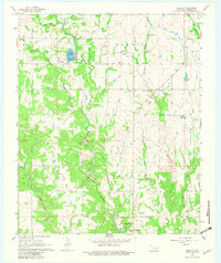
1967 Map of Reagan
USGS Topo · Published 1982About this map
Pennington Creek winds through this Johnston County landscape, serving as a focal point for the local geography and the operations of the Tishomingo National Fish Hatchery. The settlement of Reagan sits at a crossroads in the northwest, near the Pennington Ch and Greenwood Cem. The map illustrates a transitional rural economy, where the land is carved by numerous Gravel Pits and marked by a defunct Railroad Grade that once connected these hills to wider markets.
Find a feature on this map
31 named features on this map. Tap any name to fly to it.
Don’t see what you’re looking for? This feature index may not catch every label — zoom into the map to look around manually.
Map Details
Editions of this 1967 Reagan Map
2 editions found
Other maps of this area

1901 · Tishomingo
USGS Topo · 1:125,000

1957 · Ardmore
USGS Topo · 1:250,000

1963 · Ardmore
USGS Topo · 1:250,000

1963 · Mill Creek
USGS Topo · 1:24,000

1963 · Troy
USGS Topo · 1:24,000

1963 · Ravia
USGS Topo · 1:24,000

1967 · Connerville SE
USGS Topo · 1:24,000

1967 · Connerville
USGS Topo · 1:24,000
1967 · Connerville NE
USGS Topo · 1:24,000

1967 · Tishomingo
USGS Topo · 1:24,000