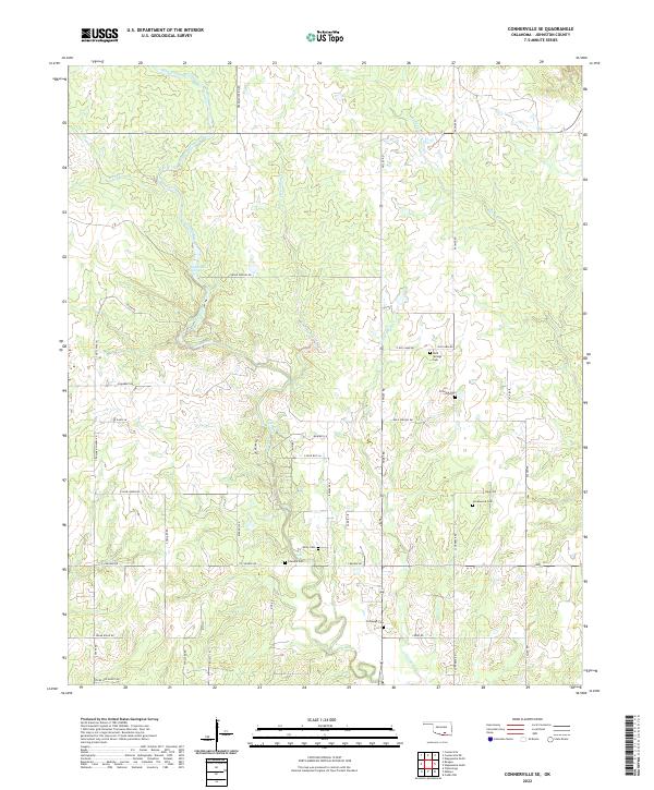
2022 Map of Connerville SE
USGS Topo · Published 2022About this map
The Blue River carves a central path through this portion of Oklahoma, creating a landscape defined by significant water features including Big Falls and Cheadle Falls. The distribution of burial sites across the township lines of Johnston County provides a clear indicator of early family settlement patterns, particularly along the waterways and rural road networks. Genealogists and local historians can locate several family-named or community cemeteries such as Bold Springs Cem, Fillmore Cem, and Greenwood Cem. The terrain is further etched by numerous named tributaries like Peter Sandy Cr and Pecan Cr, while Desperado Spring remains a notable landmark near the western edge. A grid of local routes like Deadman Spring Rd and Bold Springs Rd connects these scattered rural points of interest, reflecting the enduring agricultural and residential footprint of the area.
Find a feature on this map
52 named features on this map. Tap any name to fly to it.
Don’t see what you’re looking for? This feature index may not catch every label — zoom into the map to look around manually.
Map Details
Editions of this 2022 Connerville SE Map
This is the sole edition of this map. No revisions or reprints were ever made.
Other maps of this area

1899 · Atoka
USGS Topo · 1:125,000

1900 · Atoka
USGS Topo · 1:125,000

1901 · Tishomingo
USGS Topo · 1:125,000

1957 · Ardmore
USGS Topo · 1:250,000

1963 · Ardmore
USGS Topo · 1:250,000

1967 · Connerville SE
USGS Topo · 1:24,000

1967 · Connerville
USGS Topo · 1:24,000
1967 · Connerville NE
USGS Topo · 1:24,000

1967 · Tishomingo
USGS Topo · 1:24,000
1967 · Reagan
USGS Topo · 1:24,000