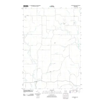
2010 Map of Connorsville
USGS Topo · Published 2010About this map
Connorsville and Reeve anchor this rural landscape in Barron County, where a complex network of waterways defines the terrain. The northern reaches are characterized by the winding path of Vance Creek and its namesake reservoir at Nordby Dam, while the southern portion is drained by Flayton Creek and Big Beaver Creek as they move toward the Hay River. This area is dotted with small local landmarks such as Erickson Field and several family or community burial grounds including Akers Cemetery, Solum Cemetery, and the New Haven Cemetery. The grid of county highways and numbered streets, such as County Hwy-V and County Hwy-Q, suggests a persistent agricultural character. The proximity of multiple cemeteries to small stream crossings provides valuable location data for genealogists tracing families in these corner townships of Wisconsin.
Find a feature on this map
58 named features on this map. Tap any name to fly to it.
Don’t see what you’re looking for? This feature index may not catch every label — zoom into the map to look around manually.
Map Details
Editions of this 2010 Connorsville Map
This is the sole edition of this map. No revisions or reprints were ever made.
Other maps of this area

1948 · Downing
USGS Topo · 1:62,500

1949 · Ridgeland
USGS Topo · 1:62,500

1950 · Downing
USGS Topo · 1:62,500

1950 · Turtle Lake
USGS Topo · 1:62,500

1951 · Ridgeland
USGS Topo · 1:62,500

1951 · Barron
USGS Topo · 1:62,500

1952 · Turtle Lake
USGS Topo · 1:62,500

1953 · Rice Lake
USGS Topo · 1:250,000

1953 · Stillwater
USGS Topo · 1:250,000

1955 · Stillwater
USGS Topo · 1:250,000