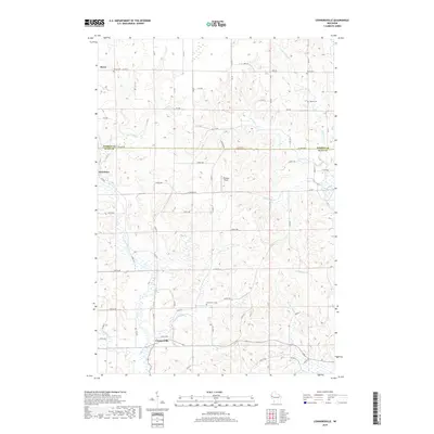
2018 Map of Connorsville
USGS Topo · Published 2018About this map
Connorsville and the surrounding agricultural lands of Dunn and Barron Counties are defined by a dense network of tributaries feeding the Hay River basin. This rural landscape in the late 2010s shows a well-preserved township-and-range grid, with small clusters of development at Reeve and Graytown. Local genealogy and land use are etched into the map through numerous small burial grounds, including Reeve Cem, Akers Cem, Solum Cem, and New Haven Cem. The drainage pattern is intricate, with water bodies such as the S Fork Hay River and Little Vance Cr carving subtle valleys through the farmland. Named landmarks like Erickson Field and a series of rural roads—ranging from Co HWY A to numeric designations like 1st Ave—illustrate the modern infrastructure supporting this northern Wisconsin farming community.
Find a feature on this map
68 named features on this map. Tap any name to fly to it.
Don’t see what you’re looking for? This feature index may not catch every label — zoom into the map to look around manually.
Map Details
Editions of this 2018 Connorsville Map
This is the sole edition of this map. No revisions or reprints were ever made.
Other maps of this area

1948 · Downing
USGS Topo · 1:62,500

1949 · Ridgeland
USGS Topo · 1:62,500

1950 · Downing
USGS Topo · 1:62,500

1950 · Turtle Lake
USGS Topo · 1:62,500

1951 · Ridgeland
USGS Topo · 1:62,500

1951 · Barron
USGS Topo · 1:62,500

1952 · Turtle Lake
USGS Topo · 1:62,500

1953 · Rice Lake
USGS Topo · 1:250,000

1953 · Stillwater
USGS Topo · 1:250,000

1955 · Stillwater
USGS Topo · 1:250,000