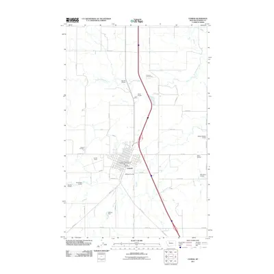
2011 Map of Conrad
USGS Topo · Published 2011About this map
Conrad serves as the focal point of this 2011 survey, showing the town's grid and essential municipal landmarks like the Conrad Post Office, Conrad Vol Fire Dept, and Conrad Airport. The landscape is defined by the agricultural and hydrological infrastructure of the High Plains, where the P-6 Canal and G Canal cut across the prairie to manage water resources. Local family and place names are preserved in the various coulees that drain toward the Dry Fork Marias River, including Uncle Sam Coulee, Boucher Coulee, and Oliver Coulee. Cultural sites such as the Whoop-up Rodeo Ground and Hillside Cemetery reflect the community's social and historical foundations. To the north, Valier Junction marks a key intersection in a transport network that includes the Old North Trl and various section-line roads like Manson Rd and Dusel Rd.
Find a feature on this map
50 named features on this map. Tap any name to fly to it.
Don’t see what you’re looking for? This feature index may not catch every label — zoom into the map to look around manually.
Map Details
Editions of this 2011 Conrad Map
This is the sole edition of this map. No revisions or reprints were ever made.
Other maps of this area

1920 · Dupuyer
USGS Topo · 1:125,000

1920 · Conrad
USGS Topo · 1:125,000

1934 · Valier
USGS Topo · 1:62,500

1937 · Valier
USGS Topo · 1:62,500

1938 · Gallup City
USGS Topo · 1:62,500

1942 · Gallup City
USGS Topo · 1:62,500

1954 · Shelby
USGS Topo · 1:250,000

1958 · Shelby
USGS Topo · 1:250,000

1960 · Cut Bank
USGS Topo · 1:250,000

1963 · Cut Bank
USGS Topo · 1:250,000