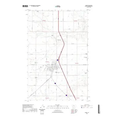
2020 Map of Conrad
USGS Topo · Published 2020About this map
Conrad serves as the focal point of this Pondera County landscape, where a grid of residential streets and civic landmarks such as the Pondera County Courthouse meet the open agriculture of the High Plains. The town's layout is defined by thoroughfares like S Main St and Sunset Blvd, with the nearby Conrad Airport and Sports Complex Rd indicating modern infrastructure development. Outside the town center, the terrain is deeply etched by a network of seasonal watercourses known locally as coulees, including Big Flat Coulee, Railroad Coulee, and Uncle Sam Coulee. This drainage system is supplemented by vital irrigation works like the G Canal and P-6 Canal, which support the region's farming economy. Evidence of earlier rural life persists in the placement of the Hillside Cem and the former sites of the Elings School and Dusell School, marking the coordinates of a dispersed pioneer community.
Find a feature on this map
124 named features on this map. Tap any name to fly to it.
Don’t see what you’re looking for? This feature index may not catch every label — zoom into the map to look around manually.
Map Details
Editions of this 2020 Conrad Map
This is the sole edition of this map. No revisions or reprints were ever made.
Other maps of this area

1920 · Dupuyer
USGS Topo · 1:125,000

1920 · Conrad
USGS Topo · 1:125,000

1934 · Valier
USGS Topo · 1:62,500

1937 · Valier
USGS Topo · 1:62,500

1938 · Gallup City
USGS Topo · 1:62,500

1942 · Gallup City
USGS Topo · 1:62,500

1954 · Shelby
USGS Topo · 1:250,000

1958 · Shelby
USGS Topo · 1:250,000

1960 · Cut Bank
USGS Topo · 1:250,000

1963 · Cut Bank
USGS Topo · 1:250,000