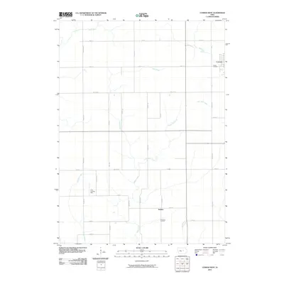
2010 Map of Conrad West
USGS Topo · Published 2010About this map
Wolf Creek and its various tributaries, including Asher Creek and Little Asher Creek, define the agricultural drainage patterns of this Grundy County landscape. The town of Conrad occupies the northeastern corner of the map, serving as a local hub near the Conrad Cemetery. Further south, the small settlement of Maulsby is situated near the Prairieville Cemetery, reflecting the early rural community structure of the region.
Find a feature on this map
28 named features on this map. Tap any name to fly to it.
Don’t see what you’re looking for? This feature index may not catch every label — zoom into the map to look around manually.
Map Details
Editions of this 2010 Conrad West Map
This is the sole edition of this map. No revisions or reprints were ever made.
Other maps of this area

1954 · Waterloo
USGS Topo · 1:250,000

1955 · Waterloo
USGS Topo · 1:250,000

1960 · Marshalltown
USGS Topo · 1:24,000

1960 · Marshalltown
USGS Topo · 1:62,500

1960 · Le Grand
USGS Topo · 1:24,000

1960 · Conrad West
USGS Topo · 1:24,000

1960 · Conrad East
USGS Topo · 1:24,000

1975 · Union
USGS Topo · 1:24,000
1975 · La Moille
USGS Topo · 1:24,000

1979 · Grundy Center
USGS Topo · 1:24,000