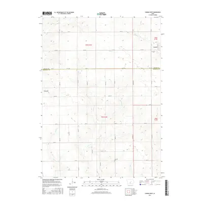
2015 Map of Conrad West
USGS Topo · Published 2015About this map
The boundary between Grundy Co and Marshall Co bisects this Iowa landscape, where the town of Conrad sits in the northeast corner and Liscomb occupies the western edge. This 2015 survey illustrates a highly structured agricultural grid, defined by a network of numbered section lines and rural roads including Co Rd D67 and 130th St. Despite the rigid human-made overlay, the natural drainage system remains prominent. Waterways such as Wolf Creek and Asher Creek meander across the plains, creating small variances in the local topography. For those researching local families, the map identifies the locations of the Conrad Cemetery and Prairieville Cemetery, serving as fixed points of interest within the expansive farmsteads of the central Iowa interior.
Find a feature on this map
25 named features on this map. Tap any name to fly to it.
Don’t see what you’re looking for? This feature index may not catch every label — zoom into the map to look around manually.
Map Details
Editions of this 2015 Conrad West Map
This is the sole edition of this map. No revisions or reprints were ever made.
Other maps of this area

1954 · Waterloo
USGS Topo · 1:250,000

1955 · Waterloo
USGS Topo · 1:250,000

1960 · Marshalltown
USGS Topo · 1:24,000

1960 · Marshalltown
USGS Topo · 1:62,500

1960 · Le Grand
USGS Topo · 1:24,000

1960 · Conrad West
USGS Topo · 1:24,000

1960 · Conrad East
USGS Topo · 1:24,000

1975 · Union
USGS Topo · 1:24,000
1975 · La Moille
USGS Topo · 1:24,000

1979 · Grundy Center
USGS Topo · 1:24,000