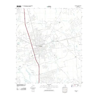
2010 Map of Conroe
USGS Topo · Published 2010About this map
Conroe serves as the central hub of this 2010 topographic study, showing the city's residential and industrial footprint as it expanded north of the West Fork San Jacinto River. The urban landscape is punctuated by several significant green spaces and historical sites, including Oakwood Cemetery and Rosewood Cemetery near the city center. Industrial activity is grounded in the Conroe Townsite Oil Field, reflecting the area's long-standing connection to resource extraction. To the north, the Montgomery County Airport and the residential developments around The Lake and Country Club Lake illustrate the transition from dense municipal blocks to suburban and recreational use. The map also documents institutional landmarks such as Camp Strake and Camp Martha Madeley, which occupy the wooded areas near Stewarts Creek and the river bottomlands.
Find a feature on this map
68 named features on this map. Tap any name to fly to it.
Don’t see what you’re looking for? This feature index may not catch every label — zoom into the map to look around manually.
Map Details
Editions of this 2010 Conroe Map
This is the sole edition of this map. No revisions or reprints were ever made.
Other maps of this area

1954 · Beaumont
USGS Topo · 1:250,000

1957 · Beaumont
USGS Topo · 1:250,000

1958 · Conroe
USGS Topo · 1:24,000

1958 · Cowl Spur
USGS Topo · 1:24,000

1958 · Lake Paula
USGS Topo · 1:24,000

1959 · Outlaw Pond
USGS Topo · 1:24,000

1959 · Cut and Shoot
USGS Topo · 1:24,000

1959 · Conroe NE
USGS Topo · 1:24,000

1960 · Willis
USGS Topo · 1:24,000
1961 · Tamina
USGS Topo · 1:24,000