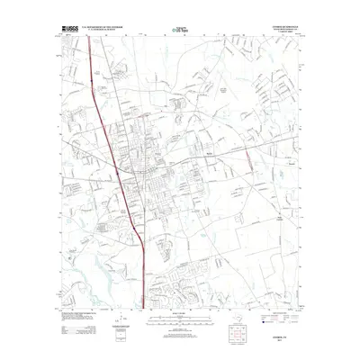
2013 Map of Conroe
USGS Topo · Published 2013About this map
Conroe Townsite Oil Field sits at the heart of this Montgomery County landscape, indicating the historical importance of petroleum to the local economy. The city is a hub of transport and recreation, bounded to the west by Country Club Lake and to the south by the W Fork San Jacinto River and Grand Lake. Industrial and civic expansion is evident in the presence of the Lone Star Executive Airport and major retail centers like Prime Outlets at Conroe.
Find a feature on this map
298 named features on this map. Tap any name to fly to it.
Don’t see what you’re looking for? This feature index may not catch every label — zoom into the map to look around manually.
Map Details
Editions of this 2013 Conroe Map
This is the sole edition of this map. No revisions or reprints were ever made.
Other maps of this area

1954 · Beaumont
USGS Topo · 1:250,000

1957 · Beaumont
USGS Topo · 1:250,000

1958 · Conroe
USGS Topo · 1:24,000

1958 · Cowl Spur
USGS Topo · 1:24,000

1958 · Lake Paula
USGS Topo · 1:24,000

1959 · Outlaw Pond
USGS Topo · 1:24,000

1959 · Cut and Shoot
USGS Topo · 1:24,000

1959 · Conroe NE
USGS Topo · 1:24,000

1960 · Willis
USGS Topo · 1:24,000
1961 · Tamina
USGS Topo · 1:24,000