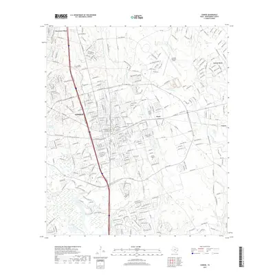
2019 Map of Conroe
USGS Topo · Published 2019About this map
The city of Conroe serves as the central hub of this 2019 survey, illustrating the significant urban expansion of this Montgomery County seat toward neighboring communities like Panorama Village and Cut and Shoot. This modern topographic study details a complex network of residential subdivisions and industrial infrastructure, notably anchored by the Lone Star Executive Airport and extensive roadway developments like League Line Rd and N Frazier St.
Find a feature on this map
311 named features on this map. Tap any name to fly to it.
Don’t see what you’re looking for? This feature index may not catch every label — zoom into the map to look around manually.
Map Details
Editions of this 2019 Conroe Map
This is the sole edition of this map. No revisions or reprints were ever made.
Other maps of this area

1954 · Beaumont
USGS Topo · 1:250,000

1957 · Beaumont
USGS Topo · 1:250,000

1958 · Conroe
USGS Topo · 1:24,000

1958 · Cowl Spur
USGS Topo · 1:24,000

1958 · Lake Paula
USGS Topo · 1:24,000

1959 · Outlaw Pond
USGS Topo · 1:24,000

1959 · Cut and Shoot
USGS Topo · 1:24,000

1959 · Conroe NE
USGS Topo · 1:24,000

1960 · Willis
USGS Topo · 1:24,000
1961 · Tamina
USGS Topo · 1:24,000