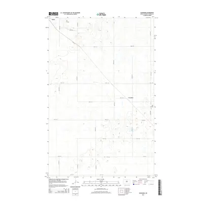
2014 Map of Considine
USGS Topo · Published 2014About this map
The settlement of Bisbee anchors the northwestern corner of this Towner County landscape, where the prairie is defined by a rhythmic grid of rural section-line roads and the winding path of Big Coulee. This 2014 survey documents the highly organized agricultural infrastructure of the region, featuring an extensive network of north-south avenues such as 60th Ave NE and east-west thoroughfares like 77th St NE. The smaller locality of Considine is situated further east, serving as a landmark within this expansive terrain. The diagonal orientation of Bisbee Rd breaks the rigid cardinal grid, reflecting a traditional transit route that connects the primary town to the outlying farmsteads. This map is particularly useful for identifying specific rural addresses and the drainage patterns of the coulees that characterize this part of North Dakota.
Find a feature on this map
18 named features on this map. Tap any name to fly to it.
Don’t see what you’re looking for? This feature index may not catch every label — zoom into the map to look around manually.
Map Details
Editions of this 2014 Considine Map
This is the sole edition of this map. No revisions or reprints were ever made.
Other maps of this area

1953 · Devils Lake
USGS Topo · 1:250,000

1956 · Devils Lake
USGS Topo · 1:250,000

1957 · Cando
USGS Topo · 1:24,000

1962 · Egeland SW
USGS Topo · 1:24,000

1962 · Snyder Lake
USGS Topo · 1:24,000

1971 · Bisbee South
USGS Topo · 1:24,000

1971 · Considine
USGS Topo · 1:24,000

1971 · Leeds NE
USGS Topo · 1:24,000

1971 · Bisbee North
USGS Topo · 1:24,000
1971 · Big Coulee Dam
USGS Topo · 1:24,000