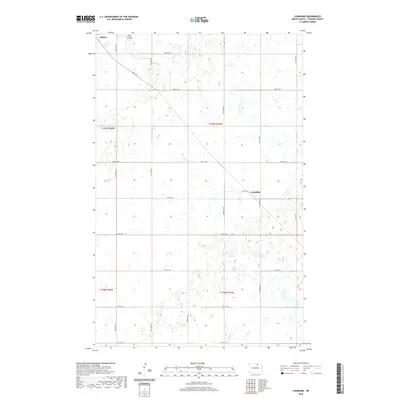
2020 Map of Considine
USGS Topo · Published 2020About this map
Bisbee anchors the northwestern corner of this Towner County landscape, where the prairie is defined by a dense network of glacial potholes and small wetlands. The terrain is characterized by the broad depression of Big Coulee, which meanders through the northern sections, influencing the local drainage and agricultural patterns. A precise grid of section-line roads, including 83rd St NE and 77th St NE, organizes the territory into the traditional townships of the Public Land Survey System. In the eastern portion of the quadrangle, the location of Considine marks a point of interest along the section roads. This 2020 map reflects a modern view of a deeply rooted rural environment, showing how transportation routes like Bisbee Rd continue to connect these isolated North Dakota settlements across a landscape shaped by its post-glacial geology.
Find a feature on this map
16 named features on this map. Tap any name to fly to it.
Don’t see what you’re looking for? This feature index may not catch every label — zoom into the map to look around manually.
Map Details
Editions of this 2020 Considine Map
This is the sole edition of this map. No revisions or reprints were ever made.
Other maps of this area

1953 · Devils Lake
USGS Topo · 1:250,000

1956 · Devils Lake
USGS Topo · 1:250,000

1957 · Cando
USGS Topo · 1:24,000

1962 · Egeland SW
USGS Topo · 1:24,000

1962 · Snyder Lake
USGS Topo · 1:24,000

1971 · Bisbee South
USGS Topo · 1:24,000

1971 · Considine
USGS Topo · 1:24,000

1971 · Leeds NE
USGS Topo · 1:24,000

1971 · Bisbee North
USGS Topo · 1:24,000
1971 · Big Coulee Dam
USGS Topo · 1:24,000