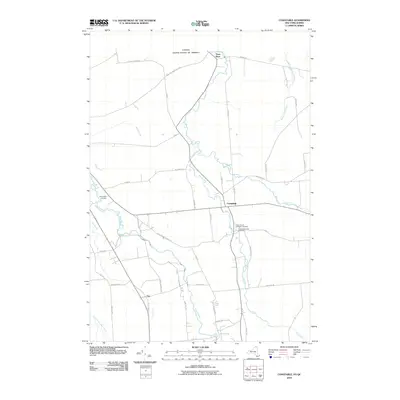
2010 Map of Constable
USGS Topo · Published 2010About this map
Trout River flows northward across the international boundary between the United States and Canada in this detailed 2010 survey of Franklin County. The settlement of Constable serves as a central hub, where the Little Trout River joins the main branch. The landscape is defined by a dense network of country roads named for local families and landmarks, such as Layman Rd, D-Connell Rd, and Bull Run Rd Plante Rd.
Find a feature on this map
48 named features on this map. Tap any name to fly to it.
Don’t see what you’re looking for? This feature index may not catch every label — zoom into the map to look around manually.
Map Details
Editions of this 2010 Constable Map
This is the sole edition of this map. No revisions or reprints were ever made.
Other maps of this area

1915 · Chateaugay
USGS Topo · 1:62,500

1915 · Malone
USGS Topo · 1:62,500

1917 · Malone
USGS Topo · 1:62,500

1943 · Chateaugay
USGS Topo · 1:62,500

1948 · Ogdensburg
USGS Topo · 1:250,000

1951 · Ogdensburg
USGS Topo · 1:250,000

1953 · Ogdensburg
USGS Topo · 1:250,000

1961 · Ogdensburg
USGS Topo · 1:250,000
1964 · Ft. Covington
USGS Topo · 1:24,000
1964 · Burke
USGS Topo · 1:24,000