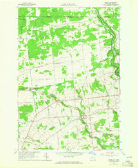
1964 Map of Burke
USGS Topo · Published 1965About this map
The international boundary between Canada and the United States defines the northern edge of this landscape, marked by a Canadian Customs Part of Entry near North Burke. The terrain transitions from the low-lying agricultural flats of Elgin and Hinchinbrook into the rising hills of Burke, where the Trout River and Little Trout River carve through the countryside. This 1964 survey captures the village of Burke near a significant drop in the river, evidenced by the presence of Falls and nearby St George Ch.
Find a feature on this map
64 named features on this map. Tap any name to fly to it.
Don’t see what you’re looking for? This feature index may not catch every label — zoom into the map to look around manually.
Map Details
Editions of this 1964 Burke Map
This is the sole edition of this map. No revisions or reprints were ever made.
Other maps of this area

1915 · Chateaugay
USGS Topo · 1:62,500

1915 · Malone
USGS Topo · 1:62,500

1917 · Malone
USGS Topo · 1:62,500

1943 · Chateaugay
USGS Topo · 1:62,500

1948 · Ogdensburg
USGS Topo · 1:250,000

1951 · Ogdensburg
USGS Topo · 1:250,000

1953 · Ogdensburg
USGS Topo · 1:250,000

1961 · Ogdensburg
USGS Topo · 1:250,000
1964 · Chateaugay
USGS Topo · 1:24,000
1964 · Constable
USGS Topo · 1:24,000