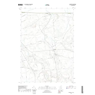
2019 Map of Constable
USGS Topo · Published 2019About this map
Constable and the surrounding borderlands of northern New York are defined by an intricate network of waterways draining toward the Canadian border. The Salmon River flows through the western portion of this terrain, while the Trout River and its tributary, the Little Trout River, move northward through the central plains. This modern survey illustrates a landscape of established rural settlements and long-standing family foundations, centered on the community of Fay and the primary village.
Find a feature on this map
67 named features on this map. Tap any name to fly to it.
Don’t see what you’re looking for? This feature index may not catch every label — zoom into the map to look around manually.
Map Details
Editions of this 2019 Constable Map
This is the sole edition of this map. No revisions or reprints were ever made.
Other maps of this area

1915 · Chateaugay
USGS Topo · 1:62,500

1915 · Malone
USGS Topo · 1:62,500

1917 · Malone
USGS Topo · 1:62,500

1943 · Chateaugay
USGS Topo · 1:62,500

1948 · Ogdensburg
USGS Topo · 1:250,000

1951 · Ogdensburg
USGS Topo · 1:250,000

1953 · Ogdensburg
USGS Topo · 1:250,000

1961 · Ogdensburg
USGS Topo · 1:250,000
1964 · Ft. Covington
USGS Topo · 1:24,000
1964 · Burke
USGS Topo · 1:24,000