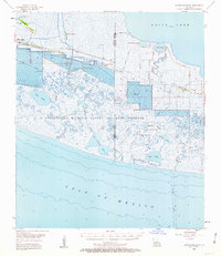
1955 Map of Constance Bayou
USGS Topo · Published 1963About this map
The Rockefeller Wildlife Refuge and Game Preserve dominates this coastal landscape along the Gulf of Mexico, where a complex network of bayous and brackish lakes meets the Louisiana shore. The 1955 survey illustrates a wilderness transitioning toward industrial utility, particularly evident in the Little Peccan Lake Gas Field and the Constance Bayou Gas Field, where gas wells, tanks, and a prominent Radio Tower mark the terrain.
Find a feature on this map
43 named features on this map. Tap any name to fly to it.
Don’t see what you’re looking for? This feature index may not catch every label — zoom into the map to look around manually.
Map Details
Editions of this 1955 Constance Bayou Map
3 editions found
Other maps of this area

1932 · Constance Bayou NE
USGS Topo · 1:31,680

1932 · Constance Bayou SW
USGS Topo · 1:31,680

1932 · Pecan Island SW
USGS Topo · 1:31,680

1932 · Constance Bayou SE
USGS Topo · 1:31,680

1932 · Constance Bayou NW
USGS Topo · 1:31,680

1934 · Catfish Lake
USGS Topo · 1:24,000

1935 · Catfish Lake
USGS Topo · 1:31,680

1945 · Pecan Island NW
USGS Topo · 1:31,680

1946 · Hog Bayou NE
USGS Topo · 1:31,680

1946 · Schooner Bayou SW
USGS Topo · 1:31,680