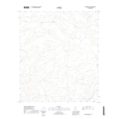
2019 Map of Continental Ranch
USGS Topo · Published 2019About this map
Continental Ranch occupies a prominent position in this arid stretch of Terrell County, defined by a network of ranch roads and deep drainage patterns. The landscape is dominated by the massive winding course of Big Canyon, which cuts through the high ground in the center of the sheet. To the north, McKay Cr follows a similar path through the limestone-scored terrain. The human footprint here is primarily tied to long-distance ranching and transportation, with the intersection of Pumpville Rd and Ranch Rd 1217 in the southeast corner providing the primary access to this isolated area. Other named routes like Stayley Rd and Hardgrave Rd trace the ridgelines and valleys, highlighting the practical nature of land use and navigation in this West Texas ranching country during the late 2010s.
Find a feature on this map
9 named features on this map. Tap any name to fly to it.
Don’t see what you’re looking for? This feature index may not catch every label — zoom into the map to look around manually.
Map Details
Editions of this 2019 Continental Ranch Map
This is the sole edition of this map. No revisions or reprints were ever made.
Other maps of this area

1928 · Sanderson
USGS Topo · 1:125,000

1954 · Fort Stockton
USGS Topo · 1:250,000

1954 · Sonora
USGS Topo · 1:250,000

1958 · Sonora
USGS Topo · 1:250,000

1958 · Fort Stockton
USGS Topo · 1:250,000

1969 · Circle Dot Ranch
USGS Topo · 1:24,000

1969 · Continental Ranch
USGS Topo · 1:24,000

1969 · Circle Dot Ranch NE
USGS Topo · 1:24,000

1969 · Dryden NE
USGS Topo · 1:24,000

1969 · Dryden NW
USGS Topo · 1:24,000