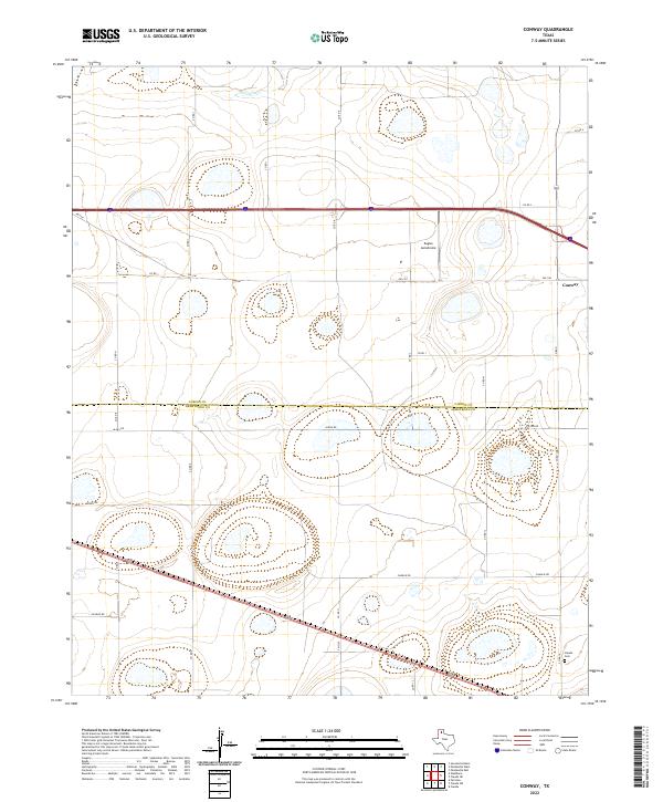
2022 Map of Conway
USGS Topo · Published 2022About this map
Conway and the surrounding Panhandle plains are documented in this contemporary mapping of the boundary between Carson Co and Armstrong Co. The settlement of Conway serves as a local hub at the intersection of several key routes, reflecting the region's historical reliance on organized road networks to navigate the expansive cattle and farming country. To the southeast, the Claude Cem provides a point of interest for genealogists tracing local families in this quiet corner of the state. The landscape is characterized by intermittent drainages like McClellan Cr and a series of playa lakes that dot the high plains. Aviation history and local transport are represented by Eagles Aerodrome, situated just south of the main thoroughfares, while the gridded system of county roads, including alphabetically named routes like Alpha Rd, Bravo Rd, and Charlie Rd, illustrates the methodical division of land that defines the region's modern layout.
Find a feature on this map
27 named features on this map. Tap any name to fly to it.
Don’t see what you’re looking for? This feature index may not catch every label — zoom into the map to look around manually.
Map Details
Editions of this 2022 Conway Map
This is the sole edition of this map. No revisions or reprints were ever made.
Other maps of this area

1953 · Sevenmile Basin
USGS Topo · 1:24,000

1954 · Amarillo
USGS Topo · 1:250,000

1956 · Washburn
USGS Topo · 1:24,000

1958 · Amarillo
USGS Topo · 1:250,000

1960 · Fairview
USGS Topo · 1:24,000

1960 · Claude
USGS Topo · 1:62,500

1966 · Panhandle West
USGS Topo · 1:24,000

1966 · Panhandle East
USGS Topo · 1:24,000
1983 · Claude
USGS Topo · 1:24,000
1983 · Claude SW
USGS Topo · 1:24,000