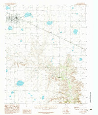
1983 Map of Claude
USGS Topo · Published 1984About this map
Claude serves as the primary focal point of this 1980s Texas Panhandle survey, showing the community's grid and development at the intersection of local transport routes. The landscape transitions from the flat plains surrounding the townsite into the deeply incised drainage of Mulberry Creek, which winds across the southern half of the sheet. This terrain contrast illustrates the characteristic break in the plains typical of the region, where level agricultural land gives way to the complex erosional patterns of the creek basin. Along the rail corridor, the settlement of Malden and the Berry railroad line facilitate the movement of goods through this rural Armstrong County territory, reflecting a landscape defined by both ranching topography and a steady rail-and-road economy.
Find a feature on this map
4 named features on this map. Tap any name to fly to it.
Don’t see what you’re looking for? This feature index may not catch every label — zoom into the map to look around manually.
Map Details
Editions of this 1983 Claude Map
This is the sole edition of this map. No revisions or reprints were ever made.
Other maps of this area

1954 · Amarillo
USGS Topo · 1:250,000

1954 · Plainview
USGS Topo · 1:250,000

1958 · Amarillo
USGS Topo · 1:250,000

1958 · Plainview
USGS Topo · 1:250,000

1960 · Claude
USGS Topo · 1:62,500

1960 · Groom
USGS Topo · 1:62,500

1963 · Blue Hole Springs
USGS Topo · 1:24,000

1963 · Luttrell Springs
USGS Topo · 1:24,000

1963 · Luttrell Springs NE
USGS Topo · 1:24,000
1983 · Lark
USGS Topo · 1:24,000