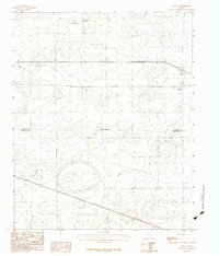
1983 Map of Conway
USGS Topo · Published 1984About this map
The settlement of Conway serves as the primary focal point of this Panhandle landscape, positioned at a significant crossroads of transportation during the early 1980s. The terrain is marked by numerous depression contours typical of the High Plains, interspersed with the headwaters of McClellan Creek in the northern reach. This survey captures the rural character of the region just as Interstate 40 and U.S. Route 66 intersect here, illustrating the transition from traditional overland routes to modern high-speed transit. The boundary between Carson Co and Armstrong Co cuts through the center of the sheet, providing a clear look at how county lines divided these agricultural and ranching lands.
Find a feature on this map
4 named features on this map. Tap any name to fly to it.
Don’t see what you’re looking for? This feature index may not catch every label — zoom into the map to look around manually.
Map Details
Editions of this 1983 Conway Map
This is the sole edition of this map. No revisions or reprints were ever made.
Other maps of this area

1953 · Sevenmile Basin
USGS Topo · 1:24,000

1954 · Amarillo
USGS Topo · 1:250,000

1956 · Washburn
USGS Topo · 1:24,000

1958 · Amarillo
USGS Topo · 1:250,000

1960 · Fairview
USGS Topo · 1:24,000

1960 · Claude
USGS Topo · 1:62,500

1966 · Panhandle West
USGS Topo · 1:24,000

1966 · Panhandle East
USGS Topo · 1:24,000
1983 · Claude
USGS Topo · 1:24,000
1983 · Claude SW
USGS Topo · 1:24,000