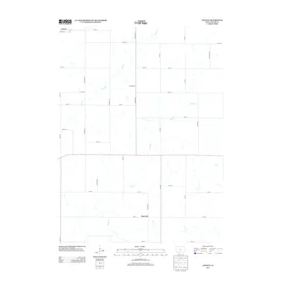
2013 Map of Conway
USGS Topo · Published 2013About this map
Conway sits in the northwest corner of this Taylor County landscape, defined by a rigid grid of rural roads and the winding paths of local waterways. The terrain is structured by a network of secondary routes and farm-to-market roads, including Farm Work Rd and Farm Field Rd, which highlight the deeply agricultural character of this corner of Iowa. In the southern portion of the quadrangle, the small settlement of Platteville is positioned near the banks of Platte Br. The drainage patterns of Honey Cr and the Platte Branch cut across the rectangular parcels of land, providing a natural contrast to the surveyed lines of the county roads like Co Hwy-J35. This survey captures the rural layout before modern consolidation altered many of the smaller township connections.
Find a feature on this map
30 named features on this map. Tap any name to fly to it.
Don’t see what you’re looking for? This feature index may not catch every label — zoom into the map to look around manually.
Map Details
Editions of this 2013 Conway Map
This is the sole edition of this map. No revisions or reprints were ever made.
Other maps of this area

1940 · Blockton
USGS Topo · 1:62,500

1940 · Bedford
USGS Topo · 1:62,500

1943 · Bedford
USGS Topo · 1:62,500

1943 · Blockton
USGS Topo · 1:62,500

1955 · Nebraska City
USGS Topo · 1:250,000

1957 · Nebraska City
USGS Topo · 1:250,000

1958 · Nebraska City
USGS Topo · 1:250,000

1980 · Gravity
USGS Topo · 1:24,000

1980 · Merle Junction
USGS Topo · 1:24,000
1980 · Bedford
USGS Topo · 1:24,000