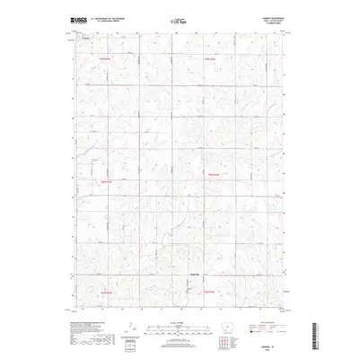
2018 Map of Conway
USGS Topo · Published 2018About this map
Conway and the surrounding township lands of Taylor County are documented here as they appeared in the early 21st century. The landscape is defined by the drainages of Honey Cr and Platte Br, which weave through a strictly organized grid of county roads and avenues. This survey captures the rural character of southwestern Iowa, where the settlement of Platteville remains a central point of reference. Local history and genealogy interest is anchored by the presence of Bower Cem and Platteville Cem, which sit among the agricultural tracts. The road network, including Co Hwy N64 and several named routes like Sherwood Ave and Quail Ave, illustrates the enduring Public Land Survey System structure that has governed this region's development since the initial land grants.
Find a feature on this map
35 named features on this map. Tap any name to fly to it.
Don’t see what you’re looking for? This feature index may not catch every label — zoom into the map to look around manually.
Map Details
Editions of this 2018 Conway Map
This is the sole edition of this map. No revisions or reprints were ever made.
Other maps of this area

1940 · Blockton
USGS Topo · 1:62,500

1940 · Bedford
USGS Topo · 1:62,500

1943 · Bedford
USGS Topo · 1:62,500

1943 · Blockton
USGS Topo · 1:62,500

1955 · Nebraska City
USGS Topo · 1:250,000

1957 · Nebraska City
USGS Topo · 1:250,000

1958 · Nebraska City
USGS Topo · 1:250,000

1980 · Gravity
USGS Topo · 1:24,000

1980 · Merle Junction
USGS Topo · 1:24,000
1980 · Bedford
USGS Topo · 1:24,000