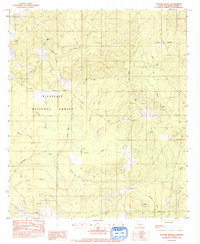
1983 Map of Coochie Brake
USGS Topo · Published 1984About this map
Coochie Brake dominates the central landscape of this Winn Parish quadrangle, providing a detailed look at the complex hydrology and forest management of central Louisiana in the early 1980s. Much of the western and southern terrain is encompassed by the Kisatchie National Forest, where a network of drainages including Nantachie Creek, Cypress Branch, and Joe Mitchell Branch weave through the timberlands. Cultural footprints are sparse but significant for genealogical research, with landmarks like Kimbrell Cem, Double Ch, and Bethlehem Ch marking established rural communities. Evidence of industrial history appears in the form of an Old R R Grade and scattered Gravel Pits, indicating how the land was utilized for transport and resource extraction prior to more modern forest conservation efforts. The map also identifies local high points such as Black Mountain near the northern boundary of the forest.
Find a feature on this map
28 named features on this map. Tap any name to fly to it.
Don’t see what you’re looking for? This feature index may not catch every label — zoom into the map to look around manually.
Map Details
Editions of this 1983 Coochie Brake Map
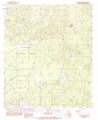
2 editions found
Other maps of this area

1932 · Colfax NW
USGS Topo · 1:31,680

1935 · Verda
USGS Topo · 1:31,680

1936 · Colfax
USGS Topo · 1:62,500

1937 · Montgomery
USGS Topo · 1:62,500

1942 · Montgomery
USGS Topo · 1:62,500

1945 · Montgomery
USGS Topo · 1:62,500

1949 · Calvin SE
USGS Topo · 1:31,680

1949 · Calvin NE
USGS Topo · 1:31,680

1949 · Calvin NW
USGS Topo · 1:31,680

1949 · Calvin SW
USGS Topo · 1:31,680