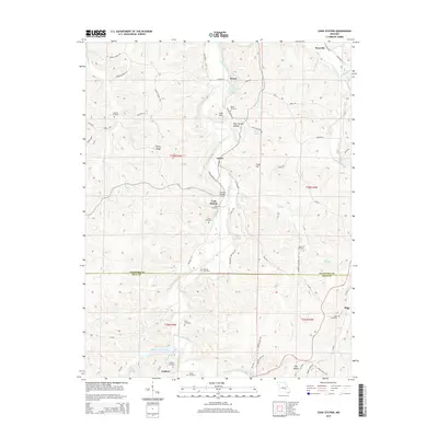
2015 Map of Cook Station
USGS Topo · Published 2015About this map
The Meramec River winds through the hills of Crawford and Dent counties, shaping a landscape defined by small valley settlements and family burial grounds. Central to the map is Cook Station, an area once critical for local commerce and transport along the river's upper reaches. The surrounding terrain is marked by distinctive ridges like Burley Ridge and isolated peaks such as Lost Mtn, with numerous springs like Anderson Spring and Lenox Spring feeding the local tributaries.
Find a feature on this map
77 named features on this map. Tap any name to fly to it.
Don’t see what you’re looking for? This feature index may not catch every label — zoom into the map to look around manually.
Map Details
Editions of this 2015 Cook Station Map
This is the sole edition of this map. No revisions or reprints were ever made.
Other maps of this area

1928 · Meramec Spring
USGS Topo · 1:62,500

1932 · Steelville
USGS Topo · 1:48,000

1933 · Steelville
USGS Topo · 1:62,500

1937 · Steelville
USGS Topo · 1:62,500

1941 · Salem
USGS Topo · 1:62,500

1941 · Stone Hill
USGS Topo · 1:62,500

1945 · Salem
USGS Topo · 1:62,500

1945 · Stone Hill
USGS Topo · 1:62,500

1949 · Rolla
USGS Topo · 1:250,000

1949 · Meramec Spring
USGS Topo · 1:62,500