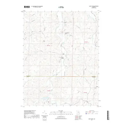
2017 Map of Cook Station
USGS Topo · Published 2017About this map
The Meramec River winds through the hills of the Crawford and Dent county line, anchoring a landscape defined by small river settlements and family burying grounds. In this section of the Ozark foothills, Cook Station and Wesco serve as primary points of habitation, connected by a network of winding roads like University Admission Rd and State Hwy M. The presence of numerous small cemeteries, including Pinto Cem, Delcour Cem, and Cooksey Cem, suggests a long history of local kinship and family farmsteads scattered across the hollows. To the south, industrial or agricultural water management is evident at Number 113 and Number 114 Reservoir, while terrain features like Burly Ridge and Lost Mtn dictate the placement of rural lanes and property boundaries.
Find a feature on this map
79 named features on this map. Tap any name to fly to it.
Don’t see what you’re looking for? This feature index may not catch every label — zoom into the map to look around manually.
Map Details
Editions of this 2017 Cook Station Map
This is the sole edition of this map. No revisions or reprints were ever made.
Other maps of this area

1928 · Meramec Spring
USGS Topo · 1:62,500

1932 · Steelville
USGS Topo · 1:48,000

1933 · Steelville
USGS Topo · 1:62,500

1937 · Steelville
USGS Topo · 1:62,500

1941 · Salem
USGS Topo · 1:62,500

1941 · Stone Hill
USGS Topo · 1:62,500

1945 · Salem
USGS Topo · 1:62,500

1945 · Stone Hill
USGS Topo · 1:62,500

1949 · Rolla
USGS Topo · 1:250,000

1949 · Meramec Spring
USGS Topo · 1:62,500