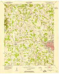
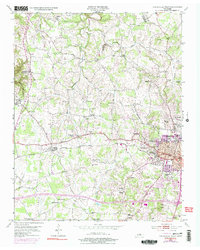
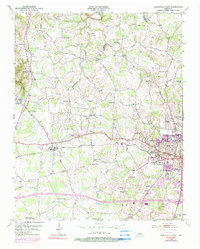
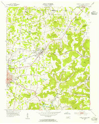
1953 Map of Cookeville West
USGS Topo · Published 1955About this map
Tennessee Polytechnic Institute serves as a major hub on the eastern edge of this mid-century survey, anchoring the growing city of Cookeville. The urban center is well-defined, featuring the General Hospital, City Hall Post Office, and several educational facilities like Central High Sch and Darwin High Sch. Moving west, the landscape transitions into a network of small rural communities and family-named landmarks connected by the Tennessee Central railroad and the Old Gainesboro Road.
Find a feature on this map
68 named features on this map. Tap any name to fly to it.
Don’t see what you’re looking for? This feature index may not catch every label — zoom into the map to look around manually.
Map Details
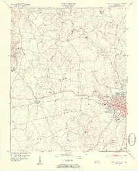
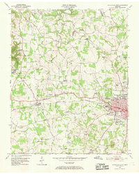
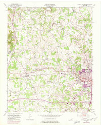
Editions of this 1953 Cookeville West Map
6 editions found
Other maps of this area

1897 · Standingstone
USGS Topo · 1:125,000

1898 · Standingstone
USGS Topo · 1:125,000
1925 · Gainesboro
USGS Topo · 1:62,500
1929 · Gainesboro
USGS Topo · 1:62,500

1943 · Cookeville
USGS Topo · 1:100,000

1944 · Cookeville
USGS Topo · 1:100,000
1951 · Windle
USGS Topo · 1:24,000
1953 · Cookeville East
USGS Topo · 1:24,000
1955 · Windle
USGS Topo · 1:24,000

1955 · Baxter
USGS Topo · 1:24,000