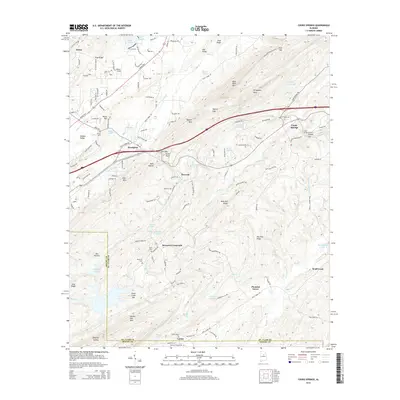
2014 Map of Cooks Springs
USGS Topo · Published 2014About this map
Cahaba Valley and the ridges of Bald Rock Mtn dominate this landscape at the intersection of St. Clair and Shelby counties. Settlement is concentrated along the valleys, with Brompton and Acmar established near the northern ridges, while Cooks Springs serves as a key transit point marked by the Cooks Springs Tunnel. The rugged geography of Double Oak Mtn and Wolf Pen Ridge is punctuated by gaps and hollows, such as Karr Gap and Hale Hollow, which have historically dictated the path of local roads and rail lines.
Find a feature on this map
143 named features on this map. Tap any name to fly to it.
Don’t see what you’re looking for? This feature index may not catch every label — zoom into the map to look around manually.
Map Details
Editions of this 2014 Cooks Springs Map
This is the sole edition of this map. No revisions or reprints were ever made.
Other maps of this area

1889 · Springville
USGS Topo · 1:125,000

1889 · Birmingham
USGS Topo · 1:125,000

1890 · Bessemer
USGS Topo · 1:125,000

1890 · Talladega
USGS Topo · 1:125,000

1892 · Birmingham
USGS Topo · 1:125,000

1892 · Springville
USGS Topo · 1:125,000

1892 · Talladega
USGS Topo · 1:125,000

1892 · Bessemer
USGS Topo · 1:125,000

1895 · Birmingham
USGS Topo · 1:125,000

1905 · Leeds
USGS Topo · 1:62,500