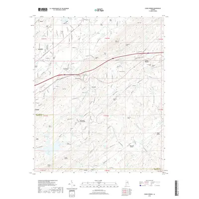
2018 Map of Cooks Springs
USGS Topo · Published 2018About this map
Cooks Springs and the surrounding ridgelines of St. Clair County are captured here during a period of sustained residential growth near Moody and Brompton. The landscape is defined by the sharp topography of Karr Mtn and Double Oak Mtn, with the Norfolk Southern railroad cutting through the terrain via the Cooks Springs Tunnel at Tunnel Hill. This corridor follows the natural passage of Karr Gap, a vital transportation link between the hills.
Find a feature on this map
154 named features on this map. Tap any name to fly to it.
Don’t see what you’re looking for? This feature index may not catch every label — zoom into the map to look around manually.
Map Details
Editions of this 2018 Cooks Springs Map
This is the sole edition of this map. No revisions or reprints were ever made.
Other maps of this area

1889 · Springville
USGS Topo · 1:125,000

1889 · Birmingham
USGS Topo · 1:125,000

1890 · Bessemer
USGS Topo · 1:125,000

1890 · Talladega
USGS Topo · 1:125,000

1892 · Birmingham
USGS Topo · 1:125,000

1892 · Springville
USGS Topo · 1:125,000

1892 · Talladega
USGS Topo · 1:125,000

1892 · Bessemer
USGS Topo · 1:125,000

1895 · Birmingham
USGS Topo · 1:125,000

1905 · Leeds
USGS Topo · 1:62,500