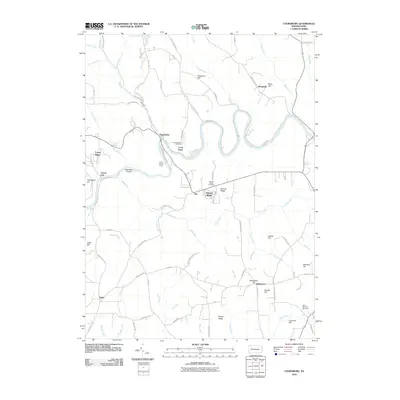
2010 Map of Cooksburg
USGS Topo · Published 2010About this map
The Clarion River winds through this portion of Clarion County, carving a deep valley that defines the local geography. Near the river’s bend, the settlement of Cooksburg serves as a focal point, flanked by the Cook Forest Cemetery and the Cook Tomb. This area is characterized by a high concentration of family-named ridges and hills, such as Thompson Hill, Fitzgerald Hill, and Hetrick Hill, which suggest long-standing land ownership patterns in the region.
Find a feature on this map
86 named features on this map. Tap any name to fly to it.
Don’t see what you’re looking for? This feature index may not catch every label — zoom into the map to look around manually.
Map Details
Editions of this 2010 Cooksburg Map
This is the sole edition of this map. No revisions or reprints were ever made.
Other maps of this area

1906 · Clarion
USGS Topo · 1:62,500

1907 · Clarion
USGS Topo · 1:62,500

1918 · Loleta
USGS Topo · 1:62,500

1922 · Tionesta
USGS Topo · 1:62,500

1924 · Tionesta
USGS Topo · 1:62,500

1924 · Brookville
USGS Topo · 1:62,500

1926 · Brookville
USGS Topo · 1:62,500

1936 · Marienville
USGS Topo · 1:48,000

1941 · Marienville
USGS Topo · 1:62,500

1944 · Brookville
USGS Topo · 1:62,500
Featured Places
- Millcreek Township, PA
- Kahletown, Eldred Township
- Cooksburg, PA
- Hottelville, Barnett Township
- Hominy Ridge, Barnett Township